Asset Mapping Intelligence · Presentation Insight
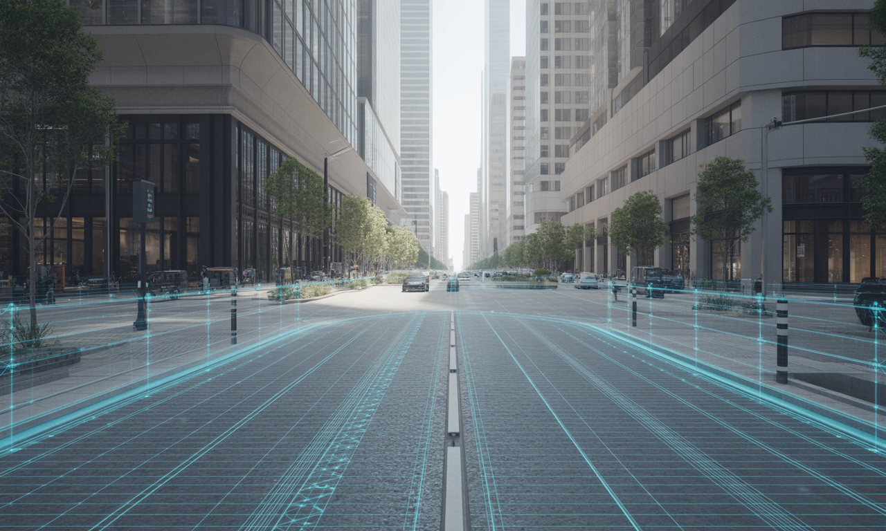
Digital Twins for Right-of-Way Compliance and Delivery
 Webinar · 2026 Series
How local governments can turn accurate field capture, GIS and reality capture into a trusted, reusable record of the public right-of-way.
Presented by AssetMapping.Events / ConnectMii Events
MODERATOR Tim Nolan, The Geospatial Network / Collin County, Texas




OVERVIEW
This presentation asked a deceptively simple question: what does it actually take to build and maintain a digital twin of the public right-of-way that an agency can trust?
Not merely a 3D visualization, but a living record that can support project scoping, compliance, design, construction, inspection and maintenance — and remain useful years after the original data was captured.
Three perspectives shaped the discussion: accurate positioning, enterprise GIS governance and real-world reality capture. Together they pointed to the same conclusion:
A useful digital twin is not defined by how impressive it looks. It is defined by whether its underlying data is accurate, governed, reusable and kept current.
The second lesson was equally important. Most digital-twin programs do not struggle because of technology alone. Problems often arise from inconsistent datums, disconnected teams, undefined schemas, unclear accuracy requirements and weak data governance.
Technology enables the record. Planning and governance make it trustworthy.
KEY TAKEAWAYS
✓ A digital twin is a decision system, not simply a visualization.
✓ Start with the decision you need to make, then specify the accuracy required.
✓ Position is foundational: errors propagate through imagery, reality capture and GIS.
✓ Capture infrastructure when it is exposed. An open trench is an opportunity that may not return for decades.
✓ Governance matters as much as technology: coordinate systems, schemas and data dictionaries should be agreed before collection begins.
✓ Start small. Add Z, then time, condition, cost and decision logic as the program matures.
✓ Design for reuse across the lifecycle: planning → design → construction → verification → operations → maintenance.
✓ Validate what you collect. Trust is earned through control, checking and documented accuracy.
PRACTICAL FIELD GUIDE
Planning a reality-capture or digital-twin project?
Use the practical checklist, accuracy guidance and crawl–walk–run roadmap later in this Insight to help structure your project before field collection begins.
PRESENTATION ONE
Accuracy Is the Anchor of the Geospatial Twin
Dr. Nik Smilovsky, GISP — Geospatial Solutions Director, Bad Elf
Where is your right-of-way record today?
Dr. Smilovsky opened by asking the audience to place their own record honestly on a four-stage maturity scale. Most organizations, he argued, know which one they are but have never said it out loud.
| Stage | Description | What it looks like in practice |
|---|---|---|
| A | Paper, PDFs, spreadsheets | Record lives in a filing cabinet and in the memory of one long-tenured employee. Nobody can answer a question without a site visit. |
| B | Aging GIS inventory | A consultant collected fire hydrants once. It was accurate then. Nothing has been recollected since the 1980s or 90s. |
| C | Consistent digital asset inventory | Field crews are actively collecting and maintaining. The record is current — but it is two-dimensional. |
| D | Three-dimensional and beyond | Elevation is in the record. Reality capture, LiDAR, photogrammetry, and a twin that can be reasoned against. |
His point about the B-to-C-to-D transition was the most practically useful of the segment: the moment you add a Z value, you are in the world of 3D, reality capture, and digital twins whether you use the vocabulary or not. An oil and gas operator tracking X and Y for regulatory purposes is one column away from a fundamentally different asset.
The crawl, walk, run approach
He offered this with deliberate self-deprecation — "this is technical, everybody write this down" — because the simplicity is the point. Organizations stall by attempting the finished state. Ask how you eat an elephant: one small bite at a time.
The practical form of crawl-walk-run is to add exactly one dimension to a workflow that already works, prove the value, and then add the next. Do not simultaneously introduce new hardware, a new coordinate system, a new schema, and a new software stack.
What a digital twin actually is
A digital twin is a mechanism, a vehicle, that turns compliance data — GIS and land surveying data — into actual decision-making capability. — DR. NIK SMILOVSKY
He assembled it in three layers.
The real world: streets, sidewalks, signs, curb ramps, utilities.
Data capture: aerial, nadir, drone, and satellite imagery; GPS and GNSS positioning; mobile LiDAR; reality capture devices including the LiDAR kit in a modern phone.
Information models: GIS. BIM. Designs, attributes, history — and temporality. Not just where we are today, but where we were yesterday, and how we predict forward.
The result is a shared, reusable, and updatable record. Not the pretty picture. The durable data being input underneath it.
The dimension stack
A framing worth reusing internally when explaining scope to non-technical stakeholders:
| 2D | A flat plane. X and Y. |
| 3D | Add elevation. Z. |
| 4D | Add time. |
| 5D | Add cost. |
| 6D | Add decision-making. This is where the digital twin lives — a living, breathing digital record of reality. |
"Yesterday we used to map what exists. Today we are starting to model what exists — but sometimes those models aren't very smart."
Every technology has a different kind of truth
This was the analytical core of the presentation, and the framing most directly applicable to procurement decisions.
| Technology | What it provides | Note |
|---|---|---|
| Imagery / photogrammetry | Context | Traditional stereo mapping from planes, drones, and satellites. AI can classify this context at speed — nearest neighbor, random forests, point cloud classification of above-ground, below-ground, and vegetation. |
| GIS | The database | A system that collects, stores, analyzes, and outputs geospatial data. |
| GNSS / GPS | The position | The anchor. Everything downstream inherits its quality. |
The dependency chain is strict and worth stating plainly: without position you cannot georeference the imagery. Without accurately positioned imagery you cannot build reliable data into a GIS. Without the GIS there is nothing for AI to run against for future inspection and analysis.
Accuracy reduces risk. Two components matter and are routinely conflated:
- Absolute accuracy — how close is your measurement to a known true location?
- Precision / repeatability — if you shot that same point 100 times, how many times would you land in the same place?
The bring-your-own-device stack
The low-cost entry path he advocated, and the same pattern Pix4D demonstrated later in the presentation:
- A phone or tablet with LTE (or satellite connectivity) and an onboard LiDAR sensor
- A high-accuracy GNSS receiver paired over Bluetooth
- An RTK correction network — now widely available, both paid and free
- A scanning application
That stack fills the office database and produces geometry that engineers, architects, and designers can use downstream in CAD. The context from 3D reality capture prevents mistakes because it gives you more data against which to make an informed decision.
Hardware referenced
Bad Elf Flex — the larger survey-grade unit. Centimeter and sub-centimeter positioning, built for reality capture and for connecting to peripheral devices.
Bad Elf Flex Mini — smaller than a palm, RTK-capable, a few centimeters of accuracy. Attaches directly to a phone or tablet to feed anchored X, Y, Z positions into a 3D scanning app or a GIS app such as Esri Field Maps.
The Bad Elf app and RTK Marketplace — a built-in directory of correction networks, paid and free, covering most of the country, with connection settings pre-populated. Pick a provider, connect once, enable auto-connect, and corrections flow in the background whenever the receiver pairs over Bluetooth. When something goes wrong, the app names the fault and the fix rather than leaving the user guessing why accuracy dropped.
Peripheral connections (raised again in Q&A): utility locators for electromagnetic subsurface location, ground-penetrating radar, and laser rangefinders for offset workflows where the point cannot be safely occupied. Also base-and-rover configurations for local RTK corrections beyond cellular coverage.
Vendor-neutral framing
He opened with an explicit disclaimer worth repeating here: everything demonstrated can be accomplished across the board with most GNSS equipment and solutions. Qualifying and selecting the device that fits your organization is the geospatial professional's own due diligence. There are other strong products on the market.
Cited research
Wang et al., 2024, Journal of Traffic and Transportation Engineering — digital twins will increasingly combine real-time data collection, synchronized visualization, simulation and modeling, and data-driven decision-making across the entire infrastructure lifecycle: planning, construction, maintenance, operations, and management.
Professional location without making every crew member become a GNSS wizard. It's almost like data collection equity. — DR. NIK SMILOVSKY
PRESENTATION TWO
From Observation to Digital Twin: A Career Arc Through Natural and Built Systems
Laura Chapa — Geospatial Solutions and Engagement Lead, City of Austin
Laura Chapa framed the digital twin not as a technology but as a recurring question that has followed her across four very different jobs: what is the thing we are trying to understand? She began her career as a botanist, moved into GIS and remote sensing, and only later recognized that she had been building digital twins the entire time without using the term.
Her structural argument: the fundamental geospatial problem does not change when the subject changes. Before you can manage a sidewalk, a curb ramp, a sign, a pavement section, a utility, or a roadway, you need to know what exists, where it exists, what it looks like, and what condition it is in. That is the same problem as mapping an invasive plant.
Chapter one — Mapping flora
Her master's thesis mapped salt cedar (Tamarix), an invasive non-native species overtaking riparian areas across the southwestern United States. The method: drone and fixed-wing imagery, GIS, and supervised image classification, producing a vegetation-pattern map the wildlife management area used to direct eradication efforts.
At the time, established workflows for drone-based vegetation mapping barely existed. The challenge was developing her own methods — a problem far more agencies face today in reality capture than they admit.
What transfers to the right-of-way: take something complex in the physical world, create a digital representation of it, and you can then measure it, analyze it, compare it, and monitor it over time.
Chapter two — Mapping a state
At Texas Parks and Wildlife Department's landscape ecology team, scope expanded from one wildlife management area to all of Texas. The Texas Ecosystem Analytical Mapper is a public web application that merged biotic and abiotic factors — dominant plants, soils, geology, weather patterns, and imagery — to identify 398 ecosystem types statewide.
The significance is temporal rather than spatial. It is a snapshot of what Texas looked like at one point in time. Repeated each decade, it becomes a change record — which is what makes it manageable rather than merely descriptive.
She was once asked, plainly, why a taxpayer should care about this work. Her answer:
If we aren't observing the world, if we're not collecting data and looking for patterns, we're making decisions with an incomplete understanding of the systems that we're responsible for. — LAURA CHAPA
That, she argued, is the same stewardship principle that applies to infrastructure.
The spectrum framing
This was the most portable concept of her presentation, and it gives agencies permission to start where they actually are.
| Type | The question it answers |
|---|---|
| Descriptive | What exists? |
| Diagnostic | What is changing? |
| Predictive | What might happen? |
| Prescriptive | What should we do? |
Digital twins do not have to be real-time or photorealistic 3D environments. An inventory of assets is not a sophisticated 3D simulation, but it is a critical component of a digital twin. It gives you digital understanding of the physical world that you can use to identify gaps, prioritize work, plan improvements, and monitor change.
Digital twins are not just about where things are. They're about where they were, where we are now, and where we're going. — LAURA CHAPA
Applied to compliance: an agency may need to document a sidewalk's condition to understand its ADA obligations. But that same information can become part of a larger record. What was there before the project? What did we change? What did we build? Was it constructed as designed? What is its condition five years from now? That is where a compliance inventory starts becoming a digital twin.
Chapter three — Community infrastructure
She joined Esri's state and local government team in February 2020, immediately before the pandemic. The Johns Hopkins COVID-19 dashboard, she argued, was a digital twin from a public-health standpoint — a shared representation decision-makers used to understand the situation, see the patterns, and act on better information.
The subject shifted from natural systems to built ones. Instead of asking where a plant species was, the questions became: where is the water line, where are the emergency assets, what is the tree canopy, what transportation infrastructure exists, what does this entity own, what condition is it in, and how does it connect to everything around it?
Work from that period:
- Winter Storm Uri, 2021 — she worked with cities that did not know where their own water lines were during a crisis in which water, electricity, food availability, and transportation were all simultaneously at risk. The value of a water-line twin is daily, but it becomes acute in an emergency.
- Emergency mapping — hurricane planning, and live resource mapping during evolving events.
- Indoor school mapping — digital twins of school interiors provided to local law enforcement for public safety.
- Tree canopy and impervious cover mapping using deep learning.
Chapter four — Digital delivery at TxDOT
She spent roughly a year and a half at the Texas Department of Transportation working on digital delivery — the multi-year effort, underway at DOTs nationally, to make the entire project lifecycle digital, standardize the processes and workflows around it, and lean on current technology throughout.
The lifecycle she walked through: planning → design → construction → verification / inspection → operations → maintenance → analysis → back into planning. Verification is the step most often skipped: was what was constructed actually what was designed?
The traditional pattern is to collect information during a project, use it to design and construct, hand over a set of documents at completion, and then lose the digital information. The questions that pattern fails to answer:
- Can the organization use it for inspection?
- Can it support maintenance?
- Can it inform the next project?
- Can it verify what was actually constructed?
The hardest part was organizational, not technical. Texas is divided into 25 districts, each often functioning as its own business unit. Creating standards that work across an organization that size requires genuine communication with the people who will use them, real input and feedback loops, and sufficient training to support them through the transition. It does not happen overnight. Every pilot project improves the next one.
She noted TxDOT is among the leaders in this space nationally and recommends reaching out directly to their team if digital delivery is on your roadmap.
Chapter five — The City of Austin today
Her current role is the governance seam across an organization building many twins at once. Austin is, by her assessment, advanced for GIS relative to peer cities nationally, and recently won the Enterprise GIS Award at the Esri User Conference.
| Project | What it is | Challenge or lesson |
|---|---|---|
| GeoHub | Self-serve public portal built on ArcGIS Hub, roughly 360 datasets covering buildings, transportation systems, parks, and more | A major win for public access; the value was in making data both easy to find and easy to use |
| Utility Network | Austin Water and Watershed migrating to Esri's utility network for water and stormwater — modeling connectivity and relationships, not just pipe locations | An entirely new model and data schema. Huge undertaking for a city this size. She strongly recommends working with an experienced partner on migration |
| AEC / capital delivery | In-house drone flights producing 3D meshes and models of parks, buildings, and active construction; city-owned drone; survey-grade ground equipment | Specify the accuracy you actually need before selecting equipment |
| Indoor GIS | Mapping interior spaces, assets, and relationships that no outdoor map can represent | Level of detail is the critical decision — too much is waste, too little is worthless. Steep learning curve. Define the strategy up front |
| ROW management plan viewer | Public web tool showing annual maintenance work scheduled in the current fiscal year | A digital representation of the plan, published so residents and stakeholders stay informed |
| Wildfire situational awareness platform | Esri suite, built after the 2011 Steiner Ranch evacuation prompted creation of a wildfire division. Shows fire extent, field-collected data, real-time firefighter tracking, wildfire and flood risk, structural fires, hazmat, and Rescue Task Force information | Fully launched for approximately one year; already used on multiple fires this summer |
| Historic Austin, 1894 | A digital twin of the city's 1894 building structures and landscape | Substantial digitization effort. Ties documented historical narrative back to location |
On accuracy specification, echoing presentation one from the buyer's side: think about what you really need. Do you need an inch? Will 30 feet do? Somewhere in between? If 30 feet is sufficient, a phone may be enough. For something like a manhole, you want to be right on the mark.
Governance is the digital twin question
These projects are not one giant digital twin. They are pieces of a larger digital representation of the city, each built by a different department to answer a different question. Her role sits across them:
- How do we make sure these systems actually work together?
- How do we establish common data practices?
- How do we make information discoverable and usable?
- How do we maintain authoritative data?
- How do we make sure the digital representation remains trustworthy as the physical world changes?
That last one, she noted, is the digital twin question.
What this means for the right-of-way
The recurring GIS operating model is straightforward:
- Observe through imagery, field survey and reliable capture.
- Understand by turning observations into governed information.
- Connect that information to asset management, transportation and other systems.
- Decide where gaps exist, what needs repair and what should be prioritized.
- Maintain the record through design, construction, inspection and future planning.
That is the evolution from an inventory to a digital twin.
Digital twins aren't really about creating a copy of the world. They're about creating a better understanding of the world. And when we understand our world better, we have an opportunity to make better decisions — for our communities, for our infrastructure, and for the generations that come after us. — LAURA CHAPA
PRESENTATION THREE
Where GIS Meets Reality Capture: Right-of-Way Digital Twins in Practice
Ashley Reade — Head of Partnerships, Pix4D
Ashley Reade located right-of-way compliance failure in three causes: fragmented data, legacy record keeping, and the cost of manual field inspection. Digital twins mitigate these by integrating high-fidelity 3D geometry from BIM and CAD with georeferenced GIS data and real-time capture.
Building directly on Laura Chapa's closing point: the twin is not a 3D model of one asset. It is the consolidation of data from every team into a single source of truth — where data meets compliance, and where decision-makers are actually enabled to decide.
The field conditions this has to survive
She was specific about why the problem persists, and it is not a data-volume problem.
In the trench: unpredictable, high-pressure excavation environments with severely limited open-trench visibility. Dust, depth, equipment. Visibility into subsurface infrastructure is challenging more often than not — which directly raises the risk of accidental utility strikes.
In the records: siloed and outdated systems. The surveying team and the GIS team have not spoken in some time and hold different sources of truth. Paper as-built documentation. CAD drawings that do not align with what is in the geodatabase. The output is gaps, conflicts, and boundaries of uncertainty that are hazardous in the field.
On site: physical encroachment and interference between vegetation and excavation, third-party consultants and contractors, incompletely understood safety risks, and plain miscommunication between teams.
The challenge isn't simply collecting more data. It's making the data spatially accurate, usable, connected to the systems teams already rely on — and capturing it safely. — ASHLEY READE
She made the safety point pointedly, using an AI-generated illustration of a worker standing in an open trench as an example of exactly what not to do — and noting it was not OSHA-compliant as a data collection method. The workflow she went on to demonstrate keeps the operator out of the trench entirely.
Case study — Pepperdine University
The driver. Pepperdine's Planning, Operations and Construction Department needed to install new fiber optic cable across campus.
The problem. Their records of buried utilities — irrigation lines, water pipes, existing cable — were outdated and incomplete. The exposure was concrete: hitting a gas line, or taking the entire campus off water for a day.
The regulatory context. New requirements in California referencing the ASCE 38-22 standard raised the bar on accurate mapping of underground infrastructure as a precondition for safe construction, efficient maintenance, and long-term planning.
The core needs:
- GIS compliance for the resulting records
- Simplified, efficient, accurate data collection
- Knowing exactly where subsurface utilities are located
- Reducing the risk of utility strikes and misinformed decisions
- Improving data sharing across departments and contractors
- Maintaining legal and institutional standards
The organizational detail that made it work. The asset survey manager also served as project manager, which meant discoveries in the field could be relayed in real time — into the geodatabase, and to the contractors working ahead of and behind him — so higher-risk areas were communicated as they were found rather than after the fact.
The strategic decision. Rather than treating the fiber installation as a single job, the team used every open trench as a capture opportunity, building a GIS-compliant record of both existing and newly installed utilities as they went. Ashley described it candidly as scope creep of the useful kind: while we have this open, let's update all our assets.
The workflow
| Step | Tool | Output |
|---|---|---|
| 1. Capture | iPhone Pro with onboard LiDAR running PIX4Dcatch, paired with a Bad Elf Flex Mini for RTK GNSS positioning | Accurate georeferenced scans, captured from a safe standoff distance outside the trench |
| 2. Fuse | Phone LiDAR combined with Pix4D photogrammetry algorithms and RTK accuracy | 3D model at approximately 2–5 cm precision |
| 3. Process | Upload to PIX4Dcloud; extract, vectorize, and classify point clouds in PIX4Dmatic Pro | Classified, usable geometry rather than an undifferentiated cloud |
| 4. Publish | Share from PIX4Dcloud directly to the system of record — ArcGIS Online today, with ArcGIS Enterprise and QGIS support coming | Geodatabase updated in near-real time |
| 5. Return to field | Stream existing feature layers, DXF, and shapefiles back into PIX4Dcatch for augmented reality | Navigate directly to a manhole, a valve, a control point, or a stakeout; see existing piping infrastructure overlaid on the real world |
Why the GNSS receiver matters here specifically: in subsurface environments, the pertinent question is how many inches — or perhaps a foot — separate one pipe from another. That is the tolerance the decision actually turns on.
The outcome
A dataset carrying full asset attribution plus X, Y, and Z for every valve and every node where a pipe bends. When a component fails or needs replacement, its location is not in question.
More broadly: a reliable record of what was actually installed and what actually exists — which is a materially different artifact from a record of what was designed.
Looking at an entire citywide map of water pipe infrastructure and trying to create that digital twin seems very overwhelming at first. But every time that trench is open, you're scanning and updating as you go. Piece by piece. — ASHLEY READE
Verifying as-built against design
A capability she flagged as underused: comparing real-world as-built conditions directly against design files inside the same environment. DXF, IFC, PDF, and GIS files set against the 3D models and scans just collected — and the reverse, taking those design files into the field through augmented reality to compare them against what is physically there.
Additional example — Massachusetts DOT
MassDOT provided three miles of bridge captured by drone imagery. Their problem was the structural supports underneath, which could not be captured from the air.
Mobile scanning filled the gap. Inspectors were then able to identify cracks at specific measured dimensions and dispatch personnel for physical inspection only where the measurements warranted it — converting a blanket inspection obligation into a targeted one.
The added benefits of a right-of-way twin
- Real-time field-to-office collaboration. Continuous visual intelligence combining drone surveillance, aerial LiDAR, terrestrial LiDAR, and mobile scanning into one platform.
- Automatic reflection of field work in the system of record, with continuous monitoring and updating.
- Durable asset knowledge: where assets are, how they are managed, and what needs to be done to them.
She closed with a live cautionary example: a city that hit a water main during rush hour, shutting down a main thoroughfare for hours. A current visualization tool and system of record is the difference between that outcome and a routine dig.
The action plan: equip field crews with mobile reality capture and GNSS rovers, build the system of record from what they capture, keep workers safe, keep the community safe, and future-proof the assets.
FIELD GUIDE
The practical guidance that emerged across all three presentations and the Q&A, consolidated. Print this section.
Before you collect — pre-project planning checklist
☐ Declare the horizontal coordinate system and projection. Write it down. Every method, every crew, every subcontractor. ☐ Declare the vertical coordinate system. This is the one that gets skipped. 3D and subsurface work does not align on horizontal agreement alone. ☐ Decide your datum explicitly. WGS84 or NAD83 — and know which one your RTK network delivers. Confirm whether you will transform to a state plane system downstream. ☐ Decide grid or ground. If this distinction is unfamiliar, resolve it before the project, not during it. GIS teams often work in grid; surveyors often work in ground. ☐ Specify required accuracy per asset class. Not one number for the project. A manhole and a park bench do not share a tolerance. ☐ Establish control strategy, including blind control points reserved for validation rather than processing. ☐ Define level of detail. Especially for indoor and 3D capture. Too much is waste; too little is unusable. ☐ Build the schema first. Get the database structure up before collection, the way a database administrator would. ☐ Set data dictionary and library permissions. Constrain what field crews can enter so unaccepted characters and free-text drift cannot corrupt attribute tables. ☐ Identify the downstream destination. Which geodatabase, which CAD environment, which asset management system — and confirm the handoff works before scale-up. ☐ Confirm who owns the resulting record, and what obligations capturing it may imply.
Accuracy specification — a working guide
| Decision the data supports | Typical tolerance | Reasonable approach |
|---|---|---|
| Subsurface utility separation, pipe bends, valves, manholes | Often centimeter-class, where the decision requires it | RTK GNSS or another fit-for-purpose survey method, with independent validation |
| Curb ramp and sidewalk slope compliance | Set from the applicable measurement and reporting requirement | Validated reality capture and positioning suited to the required tolerance |
| Sign, hydrant, bus stop, bench inventory | Varies by asset and downstream use | Mapping-grade or higher-accuracy positioning selected for the decision |
| Planning-level context | Broader tolerances may be sufficient | Existing imagery and enterprise GIS may be appropriate after fitness-for-use review |
Ask these two questions of any accuracy claim: absolute or relative? and which link in the chain — the receiver, the sensor, or the processing software?
The three causes of misaligned datasets
- Coordinate system and projection mismatch — including vertical.
- Inconsistent survey control across capture methods.
- Uncontrolled attribute entry producing discrepancies across the fields that should join the datasets.
The compliance landscape referenced
- ADA — Americans with Disabilities Act. Slope and access requirements in the public right-of-way drive much of the curb ramp and sidewalk inventory work discussed.
- PROWAG — Public Right-of-Way Accessibility Guidelines, the accessibility guidance specific to the right-of-way environment.
- MUTCD — Manual on Uniform Traffic Control Devices, governing sign and pavement marking compliance.
- ASCE 38-22 — the standard for investigating and documenting existing utilities, now referenced in California legislation and driving subsurface documentation requirements.
- 811 / call before you dig — the damage prevention context for electromagnetic utility locating and GPR workflows.
A crawl-walk-run roadmap
Crawl — Inventory one asset class you already care about, in 2D, with a known and documented accuracy. Get the schema and data dictionary right. Prove the record survives a year of maintenance.
Walk — Add the Z value to that same asset class. Add a GNSS receiver to the phones your crews already carry. Capture one corridor in 3D. Compare it against your design files.
Run — Add time and condition. Attach maintenance schedules and condition ratings. Build the capture habit into every open trench and every project closeout. Start asking predictive and prescriptive questions of the record.
AUDIENCE POLLS
Sector
- Local government — 62%
- State government, federal government, academia, industry and other — remainder
Region
- United States — 93%
- Canada, Africa and Asia — remainder
Primary business area
Public works and utilities led the field, followed by transportation, then land administration and planning, then sustainability.
Municipality population served
Over 100,000 was the largest single group. Under 25,000 and 50,000–100,000 ran close behind each other, illustrating that the audience spanned large metropolitan areas and small jurisdictions.
GIS and digital-twin adoption
The recorded response values for this question total more than 100%, and the source does not confirm whether participants could select more than one response. To avoid presenting a misleading result, the individual percentages are withheld pending confirmation by the publication owner.
Nearly half of respondents reported that they are not currently using GIS or a digital twin for this purpose, highlighting how much of the market remains at an early stage of adoption.
FULL Q&A
Questions came from the live audience. Several went unanswered when the presentation ran over — see the closing section.
Q. Can drones be used as GPS devices? Are Bad Elf GPS devices much more accurate? The example drones would be the DJI Mavic 3 Enterprise Advanced and the Matrice 30T, neither of which has an RTK kit.
DR. NIK SMILOVSKY: Short answer, no — but can a drone be used as a data collection device? Absolutely. Drones essentially all come with integrated GNSS, ranging from mapping-grade on a consumer platform to RTK-corrected on a professional one. A third option is the time-tested approach: use GNSS on the ground as control to georeference the aerial imagery — those big crosses you have seen laid out on the ground.
He then offered the framing that reframed the whole question. Think of it as a flow chart. The GNSS provides position — if it is on the drone, it positions the drone; if it is a ground target, it positions the imagery. Next comes the remote sensing device — the payload, whether RGB camera, LiDAR sensor, near-infrared, thermal, or multispectral imaging. Each of those has its own accuracy. Anyone who has zoomed into an aerial image until it pixelated has seen imagery resolution as a limit. You have to add the remote sensing device's accuracy on top of the GNSS accuracy. It snowballs. Then the software adds its own handling. Be very careful when discussing spatial accuracy across different technologies — the same word means very different things.
ASHLEY READE: RTK-equipped drones are an excellent resource and give you very accurate ground sample distance. Take drone data with an RTK payload and combine it with terrestrial data from mobile reality capture and a GNSS receiver — as long as everything is captured in the same geospatial reference, it all lines up, and you have a single project showing aerial and subsurface together.
Q. What is your experience with the surveyor community when creating digital twins? Do you have surveyors checking your digital twin data? Do you have a surveyor on staff? Is the digital twin used in planning new construction or repairs?
LAURA CHAPA: Yes on all counts. The City of Austin has surveyors on staff, they do field-check the digital twin, and the city has high-grade survey equipment for that purpose. The survey data that helps build the twin is used in new construction and in planning maintenance and repairs. She also relayed a priority from the solution architect supporting capital delivery: do as much as possible in-house, using the tools available and building the skills internally.
ASHLEY READE: Coming from a geodetic surveying background herself, and having worked with many professional land surveyors, her answer was about process rather than technology. With any organization you have to remind teams to check back in — "I've updated this" — and keep communication open between everyone involved. With surveyors specifically there are a couple of schools of thought, and some stay with the single methodology they have known and tested. There is room for growth among all of us. The key with surveyors, or any stakeholder on a project, is communication and open-mindedness.
DR. NIK SMILOVSKY: Some of the skepticism toward modern capture methods is earned, because bad data has been the result before. A land surveyor has been taught over the years to check in at the beginning of the day and check out at the end. If we do not follow those practices as other kinds of geospatial professionals, we are doing a disservice to the data — and that is where hesitation comes from. Blind control is a good practice here: data collected in the field that is deliberately not used to process the 3D data, held back solely to check the processed result against. Rigorous monitoring of the data is what earns trust.
Always recommend best practice. Check your data, check your data, check your data. — DR. NIK SMILOVSKY
Q. What are some typical inspections conducted with a digital twin, and how is the software used?
ASHLEY READE: It applies both to inspecting with an existing twin and to building one where none exists. In the examples given: fiber optic cable in new construction alongside existing infrastructure. In the Pepperdine case, existing water and gas pipes were documented while new fiber was routed, along with the design plans for where the cable would be laid relative to what was already bundled there and how it distributed to different buildings.
On inspection specifically — you are inspecting the pipeline, understanding its dimensions, what it is used for, its fabrication, and any of the typical attributes carried in your GIS data. That is the data being updated in real time. There is a measurement tool on the device. From the field you can update length, width, materials, and your attributes directly into the geodatabase.
LAURA CHAPA: From a TxDOT pilot project: using reality capture software in the field to take a designed 3D model, anchor the device to the site, and move across it to see where the model lines up with what is actually being built. During the pilots this proved very helpful — where something fell outside acceptable deviation for that inspection, changes had to be made. Catching that during inspection rather than later matters, because changes take time and put the project on hold.
DR. NIK SMILOVSKY: Bridge inspection is a strong use case — you are looking for lean, cracking, rivets, and even raptor nests where animals have built in the structure. ADA compliance in the right-of-way is another: sidewalks, curbing, and similar features have to meet slope requirements to provide equitable, safe access. A 3D digital twin lets you check whether you are within the slope compliance threshold. Once the 3D data is collected, you can write algorithms against it or extract manually, and then use GIS to generate reports — or export the reports out of the 3D software directly.
A picture speaks a thousand words. A digital twin is... a trillion? — DR. NIK SMILOVSKY
Q. How can the Bad Elf Flex Standard or Mini help guide active construction?
DR. NIK SMILOVSKY: The easiest answer is that it is a GNSS receiver — pair it with something like Esri Field Maps and go collect curbs, trees, and any above-ground asset you would traditionally survey. Beyond that:
- Attach it to a mobile reality capture app to provide position to a 3D scanning workflow.
- Connect it to a utility locator — an electromagnetic locator for underground infrastructure — for subsurface utility engineering and 811 work.
- Connect it to ground-penetrating radar.
- Connect it to a laser rangefinder for offset workflows where you cannot safely occupy the point.
"We're sort of the rug that ties the room together. Add the peripheral sensor, and we help give good accuracy."
Q. How do you turn a 3D point cloud into individual, categorized features in GIS?
ASHLEY READE: In the desktop platform you can import or process imagery directly, and there is a point classification tool that automatically detects and classifies points, with manual options to adjust as needed.
You can also bring in outside sources. If you have both LiDAR and photogrammetry, you can merge them into what Pix4D calls a dense fusion point cloud — the photogrammetry cloud, the LiDAR cloud, laser scanner data, total station data, every resource created for the project, combined into a single cloud.
From there, automatic processing and identification, then manual editing, and the ability to focus on one specific area rather than dealing with billions of points across the whole project. Extract the pertinent information, make it identifiable, and export to whatever the next system of record or destination is.
Q. I have done a lot of research on digital twin implementation. I work in a county that is geographically large but largely rural, and we do not own our own utilities. Can the ROI of digital twins work for rural areas?
DR. NIK SMILOVSKY: Yes — with the caveat that the digital twin is a very large umbrella. The conversation tends to fixate on the sophisticated, intelligent 3D models, but there is also simply three-dimensional X, Y, Z data. If you are a rural utility or hold rural assets, knowing where all your fire hydrants are, all your benches, all your bus stops, all the assets within a city or county park — that feeds reserve studies, so you can account for those assets financially, and it feeds asset management software such as Cityworks.
The scoping advice was the useful part: you may not want to go out and collect 5,000 miles of rural road with mobile reality capture. But you may very much want to capture the 50 bus stops you have in the county and have an excellent 3D model of each, so you can build a maintenance schedule around conditional ratings and make informed decisions about maintaining county property.
LAURA CHAPA: Sign inventory is the clearest rural case. In Texas especially, a windstorm can come through and knock out signs across a wide area — and without an inventory, nobody knows what sign was there or exactly where it stood. With one, you know what to replace and where, and the road is safe again sooner. Apply the same logic to whichever asset class carries the most value in your community or county.
On the utility ownership part of the question, she noted that Austin's electric utility is a separate department within the city, which changes the coordination pattern significantly from a jurisdiction that owns nothing.
Q. If a city wants to combine aerial photogrammetry with terrestrial or subsurface mapping into a single GIS, what are the biggest mistakes that prevent those datasets from lining up correctly — and what should agencies do in the field to avoid them?
LAURA CHAPA: Projections first. Make sure your data is projected correctly so it will line up. But with 3D and subsurface you are not just aligning horizontally — you have to make sure it aligns vertically as well, which means not forgetting the vertical coordinate system or projection. Horizontal and vertical reference systems both have to agree. Then on the field data side: the same, consistent survey control, so you are aligning on the ground as well as in the database.
ASHLEY READE: Agreed completely — all data captured in the same geospatial reference, same coordinate system and projection, especially when you are mixing capture methods: LiDAR, total station, laser scanner, mobile capture.
Her additional point came from mistakes she made herself in the field and later had to correct as a project manager: set your data dictionary and data library permissions correctly. When people are in the field they need to understand the exact parameters of the data they are adding. The last thing you want is someone updating an attribute table with characters the schema does not accept, because the permission was never set. Now you have misaligned characters creating discrepancies between the fields of your assets.
I've been on both ends of that — the person who made those mistakes, and the person who had to correct them. — ASHLEY READE
DR. NIK SMILOVSKY: Bad Elf gets two support questions more than any other. The first is "my GPS doesn't work" — usually because someone is trying to use it inside a building. The second is "why doesn't my data line up." The usual answer is WGS84 versus NAD83: a global system used worldwide, against a high-accuracy regional datum. And in the high-accuracy world of digital twins you are typically working with high-accuracy datums like NAD83 — with NATRF2022 arriving to replace it as part of the national reference system modernization.
The deeper problem is training. "Traditionally, GIS people didn't even know the Z value existed." He was not trained that vertical coordinate systems were a thing — everything was X and Y. His three prescriptions:
1. Get training. You do not know what you do not know, and most people have no idea. Even with a four-year degree you likely took two geodesy classes and remember little of it. If you have been clicking the same transformation in your GIS for years and assuming it works — assume nothing when you are working with 3D data. Surveyors traditionally have a better grasp of the vertical component because they have been required to collect it. If "grid versus ground" means nothing to you, that is exactly the gap — GIS professionals often live in grid, surveyors live in ground, and the two groups end up talking past each other rather than to each other. Go to a professional network event. Go to your state GIS conference.
2. You get what you pay for. Mature photogrammetry software either handles this automatically or gives you tools that mean you do not need to be a geodesist. If you are processing drone, LiDAR, and photogrammetry data through free software you found on a forum, good luck.
3. Plan. A data collection project should never be reactionary or decided in retrospect.
Prior planning prevents poor performance. If you're going to fly a drone, use GPR, use GPS — data in the air, on the ground, and below the ground — you'd better know what you're about to do. What datum am I collecting in? Am I using RTK? Am I transforming to a state plane system downstream? Set the goals ahead of time. This is why database administrators exist: get the schema up first, know your intentions, and plan it — because the way to kill a project is having to go back out and recollect. — DR. NIK SMILOVSKY
Q. How big is the GIS team at the City of Austin — in-house staff, consultants, the overall enterprise?
LAURA CHAPA: There are hundreds of GIS users. It depends on how you break it down: users logging into ArcGIS Pro regularly number a little over 100, but there are definitely hundreds of users in ArcGIS Online and the web GIS platform. Counting people doing GIS work to some degree every day regardless of job title, it is a few hundred — many of whom are not titled "GIS analyst."
Her closing point matters more than the number: it is a large and distributed program, which is a challenge, but the governance that brings everybody together is what the city does well, and that makes all the difference at that scale.
Q. Did Pepperdine have a major infrastructure project that necessitated opening the ground, and did that provide a cost-effective moment to survey existing conditions overall?
ASHLEY READE: Yes, exactly. They were installing fiber optic cable across campus, and with the ASCE 38-22 requirements implemented the same year, they took advantage of needing to lay more cable to simultaneously update their asset management and geodatabase for critical infrastructure. The project stemmed from the fiber need and expanded from there — scope creep of the productive kind: while we have this open, let's update all our assets while we're here.
Q. Was anyone at Pepperdine concerned that capturing utility data implied ownership and responsibility for the accuracy of the fiber optic data — versus leaving that responsibility with the utility providers and calling 811 when the information is needed?
ASHLEY READE: She was candid that she does not know who the utility owner was in every case, and that utility ownership in this scenario is something of a gray area. What she could speak to is the university's reasoning: rather than relying on utility owners who might not have the ability or the timing to capture data while the ground was open, they took ownership of their own system of record — because they wanted to understand what their infrastructure looks like as it relates to the university's own buildings and property.
The distinction worth carrying forward: taking ownership of a record is not the same as taking ownership of an asset, and the two questions should be answered separately and deliberately at project scoping.
GLOSSARY
GNSS — Global Navigation Satellite System. The umbrella term covering GPS and the other global constellations. Provides position.
RTK — Real-Time Kinematic. A correction technique delivering centimeter-level positioning by referencing a base station or a correction network in real time.
SBAS — Satellite-Based Augmentation System. Correction delivering reliable mapping-grade accuracy, a step below RTK.
Absolute accuracy — How close a measurement is to the known true location.
Precision / repeatability — How consistently the same point is measured across repeated observations.
WGS84 — World Geodetic System 1984. A global datum.
NAD83 — North American Datum of 1983. The high-accuracy regional datum in common use across North America.
NATRF2022 — The North American Terrestrial Reference Frame replacing NAD83 as part of the national reference system modernization.
Grid vs. ground — Grid coordinates are projected onto a flat plane; ground distances are measured on the earth's surface. GIS teams commonly work in grid, surveyors in ground. Mixing them without a stated conversion is a leading cause of misalignment.
Digital twin — A shared, reusable, updatable digital record of a physical system, capable of supporting decisions rather than only depicting conditions.
Reality capture — Capturing existing physical conditions as 3D data, via LiDAR, photogrammetry, or both.
Photogrammetry — Deriving measurements and 3D geometry from overlapping 2D imagery.
Point cloud — The dense set of 3D points produced by LiDAR or photogrammetry, before classification into meaningful features.
Dense fusion point cloud — A merged cloud combining photogrammetry, LiDAR, laser scanner, and total station data into a single dataset.
Classification — Sorting point cloud points into categories (ground, vegetation, structure, utility) so they can become GIS features.
BIM — Building Information Modeling. The building-side counterpart to GIS, carrying design intent and component data.
Digital delivery — Making the full project lifecycle digital and standardized, from planning through maintenance, so information survives each handoff.
Utility network — A GIS data model that captures connectivity and relationships between utility components, not just their locations.
SUE — Subsurface Utility Engineering. The discipline of investigating and documenting existing underground utilities.
GSD — Ground Sample Distance. The real-world size represented by one pixel of aerial imagery; a core measure of imagery resolution.
Blind control — Control points deliberately withheld from processing, used solely to validate the accuracy of the processed result.
BYOD — Bring Your Own Device. Pairing a consumer phone or tablet with a professional-grade GNSS receiver instead of buying a dedicated field unit.
AR stakeout — Using augmented reality on a mobile device to navigate to a buried or planned asset location in the field.
SPEAKERS
Tim Nolan — Moderator
Senior IT Manager, Collin County, Texas · President-Elect, Geospatial Professional Network
Tim Nolan brings more than 30 years of local-government, geospatial, Lean and Agile leadership to the presentation. At Collin County, he helps lead information technology, records management, GIS and rural addressing services. Earlier roles as GIS administrator and database administrator included helping build a multi-department enterprise GIS from a state 911 addressing mandate. That system now supports emergency preparedness, public safety, elections and right-of-way work. As President-Elect of the Geospatial Professional Network, Nolan also contributes a practitioner-focused perspective on professional education and the business of geospatial work.
Dr. Nik Smilovsky, GISP
Geospatial Solutions Director, Bad Elf
Dr. Nik Smilovsky leads geospatial solutions at Bad Elf, working with organizations to design field-data collection practices, training and fit-for-purpose positioning workflows. He is also an Arizona State University faculty member who teaches GIS and design. A GISP, certified arborist and Part 107 UAV pilot, he holds a Ph.D. focused on behavioral geography and environmental perception and an M.S. in Geographic Information Systems. His contribution to this presentation centered on geodesy, GNSS, accuracy validation and the practical use of mobile devices with professional positioning tools.
Laura Chapa
Geospatial Solutions and Engagement Lead, City of Austin
Laura Chapa connects geospatial technology, governance and the people who use it across City of Austin departments. Her work focuses on common data practices, discoverability, system interoperability and maintaining authoritative information as the physical city changes. Chapa began as a botanist and moved into GIS and remote sensing, with experience spanning Texas Parks and Wildlife, Esri, TxDOT digital delivery and enterprise GIS. She holds an M.S. from Texas State University and teaches at Austin Community College. Her presentation perspective linked observation, institutional governance and lifecycle decision-making.
Ashley Reade
Head of Partnerships, Pix4D
Ashley Reade brings more than 13 years of geospatial and environmental experience to her partnerships role at Pix4D. Her background includes GIS analysis, geospatial research, geodetic surveying and environmental science, including data acquisition and management for federal and large-scale projects. She now works with agencies, universities and transportation organizations applying reality-capture technology to infrastructure workflows. In this presentation, Reade focused on safe field capture, data governance and moving georeferenced 3D information into systems of record, drawing on the Pepperdine University and Massachusetts DOT examples.
ABOUT THE ORGANIZATIONS
Bad Elf — presentation sponsor. A GNSS technology company with roughly 17 years in the market, producing accurate, affordable, and versatile positioning tools for GIS professionals, land surveyors, and field teams. The company cut its teeth in the aviation and marine industries before expanding into geospatial. Solutions connect to iOS, Android, and Windows applications.
The Bad Elf Flex delivers survey-grade centimeter and sub-centimeter positioning and is built for reality capture and peripheral device connection. The Flex Mini is a palm-sized RTK receiver that attaches to a phone or tablet for terrestrial scanning, mobile GIS, and field documentation. Both support setting ground control points for drone mapping, collecting positions for reality capture, pairing with laser rangefinders for offset workflows in GNSS-challenged spaces, and base-and-rover configurations for local RTK corrections beyond cellular coverage.
Bad Elf is a certified small business, assembled in the United States, a GISCI supporting and endorsing organization, an Esri partner, and available on GSA and Texas DIR. Support and geospatial enablement guidance are included, with the stated aim of getting new users productive without requiring every crew member to become a GNSS expert.
And no — as Dr. Smilovsky clarified on air — Bad Elf is not a skateboard company.
Pix4D. A Switzerland-based company founded in 2011, and a global pioneer in photogrammetry and 3D reality capture technology. Pix4D transforms standard images from drones and mobile devices into highly accurate 2D models and immersive 3D models, specializing in digitizing and monitoring critical infrastructure. The stated mission is turning visual data into actionable insight so organizations can survey assets, streamline inspection workflows, and map with precision.
Products referenced in this presentation: PIX4Dcatch (mobile reality capture with AR stakeout and design file streaming), PIX4Dcloud (processing and sharing to system of record), and PIX4Dmatic Pro (point cloud classification, vectorization, extraction, and dense fusion).
City of Austin. Winner of the Enterprise GIS Award at the Esri User Conference, with hundreds of GIS users across departments, roughly 360 public datasets on its GeoHub, and a governance model that keeps a large distributed program coherent.
World Geospatial Industry Council (WGIC). Sponsor of the 2026 Smart Compliance in the Right-of-Way series.
The Geospatial Professional Network (GPN). Formerly URISA, rebranded to center the working geospatial professional. Regional and national events are a recommended training path for the geodesy and datum gaps discussed in this presentation.
Collin County, Texas. One of the fastest-growing counties in the United States, with a mature multi-departmental enterprise GIS supporting emergency preparedness, crime analysis, elections, rural addressing, and public works right-of-way management.
RESOURCES
FROM THIS PRESENTATION
Watch the Presentation
Click here to view Archive Video of the Digital Twins for ROW Compliance and Delivery session
Download the Speaker Presentations
Slides and supporting materials shared during the presentation. Contact the event team for current availability.
2026 Smart Compliance in the Right-of-Way Series
Digital Twins for ROW Compliance and Delivery — Event Page
Presentation overview, speakers and supporting information.
ORGANIZATIONS & TOOLS REFERENCED
Bad Elf
High-accuracy GNSS and mobile field positioning.
Pix4D
Photogrammetry, reality capture and 3D mapping.
Austin GeoHub
City of Austin public geospatial data portal.
Texas Ecosystem Analytical Mapper
Statewide ecosystem mapping resource.
Geospatial Professional Network (GPN)
Professional education and networking for geospatial practitioners.
World Geospatial Industry Council (WGIC)
Global geospatial industry association.
STANDARDS & GUIDANCE REFERENCED
ASCE 38-22
Standard Guideline for Investigating and Documenting Existing Utilities.
PROWAG
Public Right-of-Way Accessibility Guidelines.
MUTCD, 11th Edition
Manual on Uniform Traffic Control Devices.
NOAA / NGS Reference System Modernization
Guidance on the transition from NAD83 to the modernized National Spatial Reference System.
CONTINUE THE SERIES
Asset Mapping Intelligence brings together practical guidance from public-sector practitioners and geospatial specialists working across right-of-way compliance, transportation and infrastructure delivery.
Thank you to Bad Elf for sponsoring this presentation, to the World Geospatial Industry Council for sponsoring the 2026 Smart Compliance in the Right-of-Way series, and to the City of Austin, Collin County and Pix4D for contributing their expertise.
ConnectMii Events · AssetMapping.Events
This report was compiled from the presentation recording and transcript. Statements are attributed to the speaker who made them and reflect their views rather than those of their employers. Where a speaker referenced a specific standard, datum or regulation, we have used the current official designation. Product capabilities described reflect what was stated during the presentation and are subject to change — confirm current specifications with the vendor.